FEATURE / 01 · TERRITORY MANAGEMENT

Territory management software — draw boundaries, assign teams, watch coverage fill in.

Polygon a neighborhood directly on a Mapbox map, or import the GeoJSON and KML turf files you already have. Every contact inside the boundary becomes a walk list, and coverage fills in live as the team walks the polygons.

Map
Mapbox
Import
GeoJSON · KML
Hierarchy
Region · district · precinct
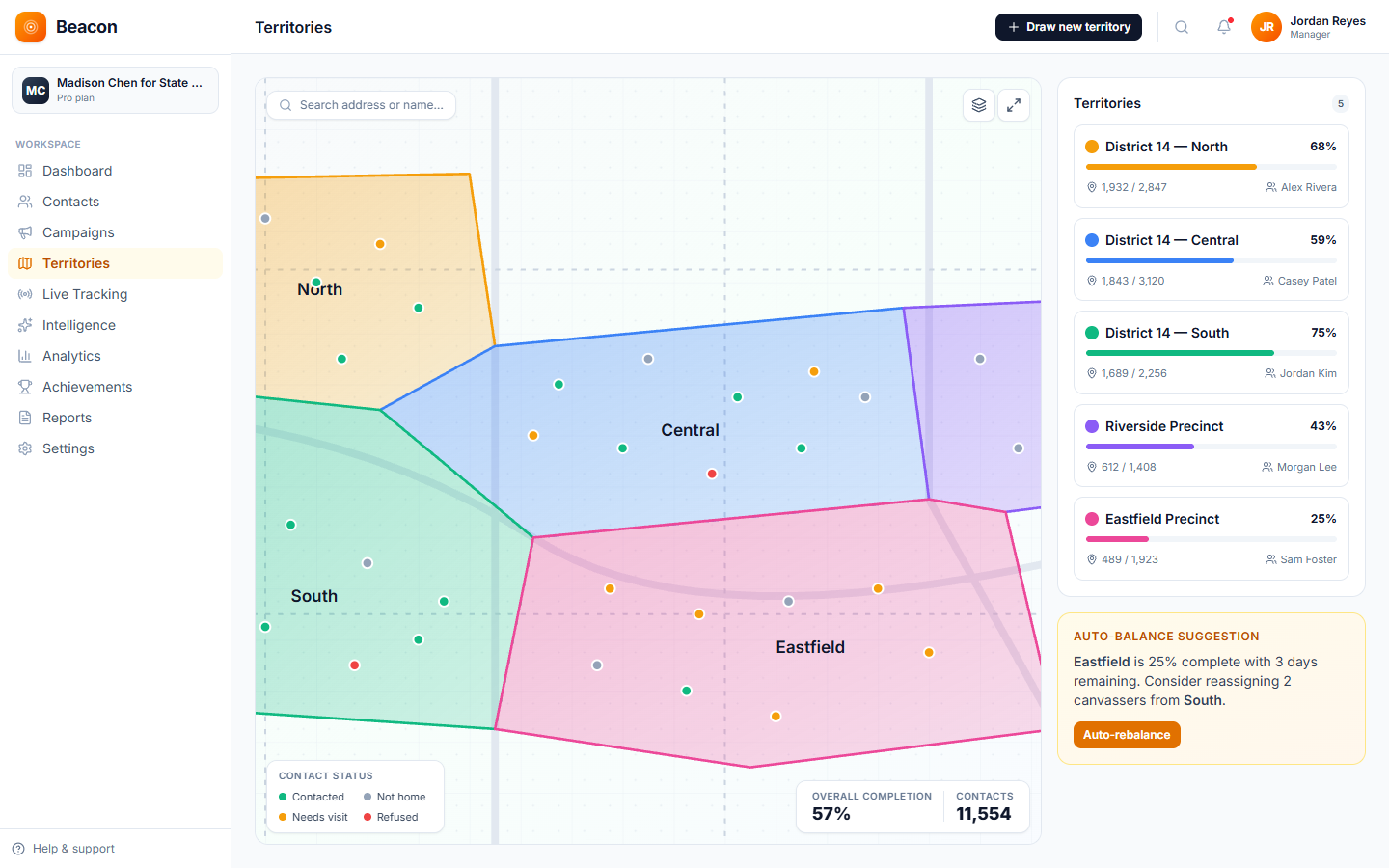
DISTRICT 14 · 5 TURFS · LIVE COVERAGE
Beacon territories page with five color-coded polygon districts on a map, live coverage percentages and auto-balance suggestions
Built for  state-house GOTV · multi-state sales routes · advocacy field programs polygon · import · overlap · coverage

— Capabilities

Canvassing territory mapping built for the way field ops work

A Mapbox base layer pairs with click-to-draw polygons, file import for boundaries you already maintain, and overlap warnings that fire before two canvassers end up at the same door.

/01 — DRAW

Polygon territories drawn directly on the map

Click points on a Mapbox map to draw a turf, then name it, save it, and assign it. The voters or contacts inside the polygon become a walk list automatically.

  • Click-to-draw polygon tool
  • Edit points after the fact
  • Color-code by program or stage

/02 — IMPORT

GeoJSON & KML territory import

If you already have boundary files from a redistricting tool, the SOS, or your nonprofit's GIS team, upload them and the polygon territories drop into Beacon with their geometry preserved.

  • GeoJSON file upload
  • KML file upload
  • Geometry preserved exactly

/03 — STRUCTURE

Nested territory hierarchy for turf cutting

Parent-child territories let you model the structure your operation already uses — region rolls up to district, district rolls up to precinct, and the stats roll up the same way.

  • Region › district › precinct
  • Auto contact-to-turf assignment by geocode
  • Overlap detection at save

— Coverage

Live territory coverage fills the polygon as the team walks

Each turf carries a live coverage percentage, and the polygon shades in as doors get knocked. Field directors can see under-walked turfs at a glance and re-cut or reassign them as needed.

  • District 14 — North 4,287 doors · 49% covered
  • District 14 — Central 3,895 doors · 71% covered
  • District 14 — South 2,148 doors · 38% covered
  • Eastfield Precinct 1,532 doors · 81% covered
  • Riverside Precinct 985 doors · 62% covered
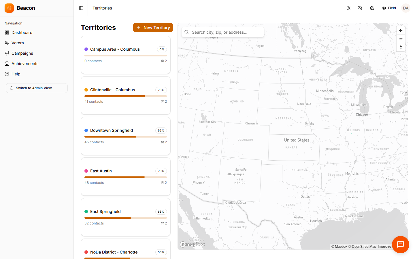
Beacon territory list view showing canvasser assignments and coverage progress across five polygon turfs

— How a turf gets built

How turf cutting works in Beacon's territory management software

The same loop runs whether you're drawing one precinct or importing three hundred at once.

/01

Draw or import

Polygon a neighborhood on the map or upload GeoJSON / KML. Overlap detection runs at save and flags any conflicts visually.

/02

Assign canvassers

Drag canvassers onto the turf. Contacts inside the polygon attach automatically by their geocoded address, so there's no manual lookup.

/03

Watch coverage

The heatmap updates as interactions log, so gaps are visible and a turf can be re-cut when the universe changes. The walk lists update along with it.

/04

Roll up & review

Child turfs roll up to parent totals, and coverage exports by region or precinct for the post-program debrief.

— FAQ

Territory management software questions, answered

Q / 01

Can I import existing territory boundaries?

Yes. Upload GeoJSON or KML and the territories are created with their polygon geometry preserved. You can also draw directly on the Mapbox map if you'd rather start from scratch.

Q / 02

How does territory overlap detection work?

When you create or edit a turf, Beacon checks it against every existing territory in your org, highlights any overlapping geometry on the map, and lists the conflicting turfs by name.

Q / 03

Can polygon territories nest in a hierarchy?

Yes. Parent-child relationships let you model Region › District › Precinct or whatever hierarchy your operation uses, and child stats roll up cleanly to parent totals.

Q / 04

How are contacts assigned to a turf?

Each contact's geocoded address is checked against polygon boundaries on import, and the contact attaches automatically to the turf that contains its location. No manual lookup needed.

— Start drawing

Cut your first canvassing territory this week

Open an account, draw a polygon, and import your contact list. Most programs are knocking within three days.

Free trial
14 days, full access, no card
Every plan
Includes territory management
Canvassers
Unlimited on every tier